“The cape represents one of the toughest stretches of open water along the BC coast” - John Kimantis, Wild Coast V. 2, describing Cape Caution
Leg 3: Port Hardy to Shearwater, 6 days, 130 miles.
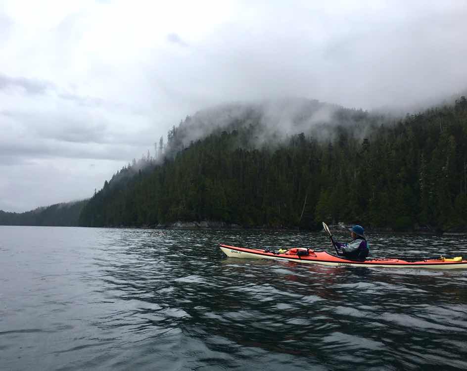
This section held our fourth and most intimidating crux of the trip, Cape Caution (well, maybe tied for most intimidating with Dixon Entrance...)

Day 1: We left Port Hardy early in the morning with the goal of crossing Queen Charlotte Strait. The 18 mile crossing from Vancouver to the mainland is exposed to swell from the Pacific Ocean. Luckily for us, the crossing is littered with small island groups which make the 18 miles a series of 4 smaller, more manageable stretches. Paddling out of Port Hardy we enjoyed watching adorable sea otters eat, dive, play, and watch us.
We endured a head wind/side wind for most of the crossing, as well as some pretty big swell. Swell is a new experience for the both of us, with our past kayaking being limited to protected bodies of water. It was a weird sensation to have hills of water 3-6 feet tall rolling underneath us, picking us up and setting us down continuously. Brooke ended up getting a little nauseous from the motion. When navigating through one of the groups of islands, we heard and then saw a humpback feeding by a fish farm. It was the first whale fluke we saw!
Once we made it to the mainland around 4pm, we decided to push on 10 more miles to a campsite called Skull Cove which would put us in a position to paddle Cape Caution the following day. We knew we had a weather window for the Cape that wouldn’t last long, so the sooner we could get past Cape Caution the better.
Once in Skull Cove, around 7:30pm, we were surprised to see a boat and a guy, Andrew, on the beach. He said there are some old squatters cabins in the woods that are in good shape and we’re welcome to use them. He was out there with 4 other guys doing a film project. The cabin was small but free of mice and spiders so we called it home for the night.

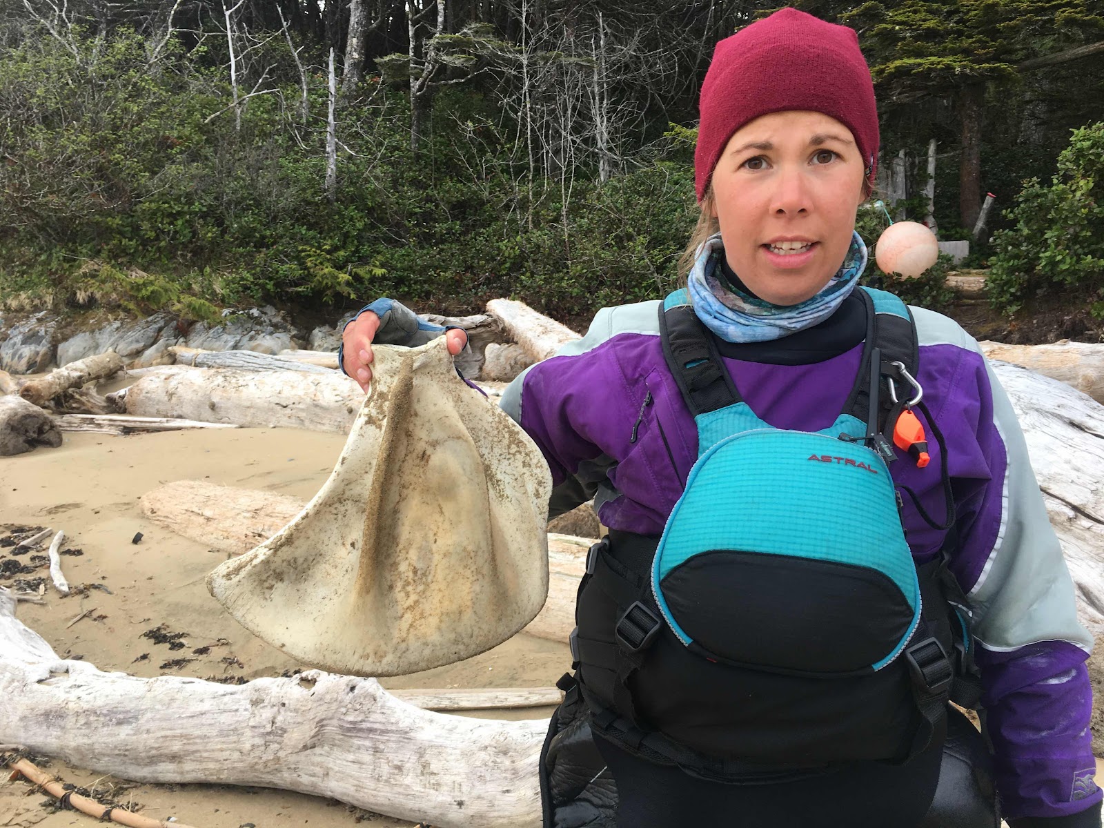
Day 2: Wake up at 4am, cook breakfast, pack up, load the boats, and go. We had about 14 miles until we reached Cape Caution and we were anxious to get it over with as soon as possible. We could not have asked for a better day to go around the cape. There was hardly any wind and only a 1 meter (3 foot) swell. Stopped for a break on the sandy Burnett Bay beach and saw wolf tracks. We also found a bone we are sure came from a bigger sea mammal. Once we were around the cape we continued on until Smith Sound, a large protected body of water.
In Smith Sound it was low tide and we enjoyed seeing the healthy intertidal ecosystem in full display. Green anemones, leather stars, red blood stars, ochre stars ranging from bright orange to vibrant purple to maroon, purple urchins, and even abalone covered the rocks. We saw about 10 abalone, and the beaches were covered with abalone shells. The native people in the area used to harvest abalone only during low tide from their canoes. This ensured over harvesting did not happen, but once a diving abalone fishery opened the abalone populations were decimated. It was nice to see that they seemed to be healthy here.
After enjoying a red sand beach with more wolf tracks, we paddled 6 more miles to Brown Island, where we camped on a shell midden for the night.
Shell middens are beaches that are made entirely of clam, barnacle, mussel, abalone, and sea snail shells. These are indicators that native settlements, communities, or gathering places are nearby. Shellfish were a main staple in the diets of native peoples, and for over ten thousand years the shells from all their meals have piled up to make beaches. The midden site specifically is where they put all of the “trash” (shells) from their meals. The shells then are broken down over time from waves and start to resemble a course white sand.


Day 3: After paddling nearly 60 miles in two days, our bodies were exhausted. We slept in until 8:30, made breakfast in the rain, and paddled 13 easy miles to Fury Island where we found a nice little kayaker camp tucked into the woods. It was raining pretty hard so we spent most our time under our tarp. There was even a picnic table and an outhouse tucked into the trees which is always a luxury.

Day 4: Today was pretty simple logistically. We didn’t have any major obstacles to cross or overcome. We simply paddled north in Fitz Hugh Sound all day. We decided to go 24 miles to the Koeye River (pronounced Kway) where there is a camp and retreat owned by the Heiltsuk First Nations. They are known to be open to sea kayakers looking for a place to camp.
Once in Koeye, we met some of the folks working there and they not only let us camp but also let us use their well equipped kitchen- such a treat. Two dogs on the property kept us company as we set up the tent and cooked our dinner. After dinner we enjoyed a spectacular sunset.


Day 5: As we left Koeye, one of the dogs, Miksuk, wouldn’t leave us alone and seemed to be saying “instead of leaving, why don’t you stay and play with me?”
The day was rather uneventful, but very long. Went up Fitz Hugh, crossed Burke Channel, crossed Fischer Channel, and entered Lama Passage. We found a nice camp next to Serpent Point that was tucked back into the woods. Around our camp we saw a lot of cedar strips removed from some of the trees.
Natives in the area use cedar trees for just about everything. The cedar was so important to their life that their name for cedar literally means “tree of life.” Cedar strips are very long strips of bark that they have removed from the tree- most of the strips were well over 30 feet long! The tree is left with a section free of bark. We aren’t sure how much this hinders the cedar growth, but they have been harvesting cedar strips for over ten thousand years and cedar trees still exist so it must be reasonably sustainable.

Day 6: We weren’t in a huge rush this morning as we only had 13 miles to Shearwater. We cruised up Lama Passage with the flood current and arrived in Shearwater around 1pm. After almost a week of solitude even this tiny town and all the boats around us were a shock. We’re enjoying the one restaurant and one coffee shop during our rest day.
Tomorrow we will start our longest leg of the trip, Shearwater to Prince Rupert, which will be 200 miles. The campable spots are pretty spread out and steep walls make it hard to land for breaks which makes a lot of kayakers avoid this area. When talking to Andrew in skull cove, he said he would rather paddle out in the open water “outside passage” than do this next bit we are doing, simply for better beaches to land at. And he has spent a lot of time kayaking up here. So wish us luck!
-Brooke and Casey


Wonderful effort getting up to Bella Bella. I second Andrew's suggestion. If you can swing it go outside of the inside but not all the way outside, way better than Grenville. Take care and take your time. The trip will be over before you know it.
ReplyDeleteReally enjoyed reading this post — as I have all of 'em! Curious if you found the "Magical Cabin" at Burnett Bay, and if so, what condition it was in... Feel free to PM if ya want. You're probably close to Klemtu by now. I have a feeling "The Ditch" will be kind to you. Stop by Oona River and stay at the B&B there! Say hi to Jan Lemon if ya do. Prince Rupert — here you come!!!
ReplyDeleteOur bladders were exploding as we pulled into Burnett Bay and went to the south shore to avoid the swell. We found a Kayak Bill site over there, and didn't explore much around the rest of the South shore or the North shore. Didn't stop in Oona river either, the water was being too kind to us at that point, we had to keep moving!
DeleteHi Brooke & Casey, We met you just outside Skull Cove. This has been our first opportunity to check your blog. Glad to see yo made to Shearwater. Wishing you safe travels and magical moments. That stretch from Shearwater to Prince Rupert is beautiful. If our paths cross while in Alaska there is a hot shower and a warm meal waiting. All the best, Hans & Terri on “Mellow Moments”
ReplyDeleteWould love to see you again! Thanks for the conversation and the well wishes!
DeleteBrooke, in the picture of you with the big bone, your face looks so much like an expression your dad would make.
ReplyDeleteChanneling his curiosity and weirdness every where I go :)
DeleteIf the cabin had mice or spiders you wouldn't have stayed in them?
ReplyDeleteNot sure actually! Rat poop can carry a disease so we would probably avoid small places with it.. spiders.. depends on if they are scary!
DeleteOne more comment! The sunset photo looks like one David and I saw on Facebook and it said something about a patriotic sunset. David thought maybe it was photo shopped. Looking at your picture makes me think maybe not.
ReplyDeleteOurs maybe has a bit of iphone enhancement, but not edited! The sky was actually that pretty!
Delete